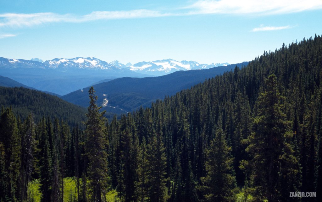
AUGUST 2002 – Panorama view showing Highway 20 near Bella Coola in B.C., Canada, against a backdrop of the Coast Mountains. © Mark Zanzig/zanzig.com
The story behind the image
The Big Hill separates Bella Coola in British Columbia from the rest of Canada, and this photo shows why. Just Highway 20 connects Bella Coola to Williams Lake, the next city, situated about 450 kilometers to the East. That’s why the highway is called the Freedom Highway. Back in the 1940s, the government claimed it was impossible to build the road. However, the locals took things into their own hands, and on 26th September 1953 they completed the road. You can find out more about this road at the Bella Coola Valley Museum.
The highway has some steep grades – up to 18% – on a well-maintained road that can be quite narrow at times. The Western segments of the highway are made from gravel, so a 4×4 truck is better suited for the highway than your typical sedan.
I adore this photo because it yells “nature!” at me. The incredibly large woods of Western B.C., on primarily untouched land are home to countless species. It is very quiet up there as there’s almost no traffic. Despite its true size, the highway looks tiny as it is embedded in the landscape. One can easily understand why it has been such a massive effort to build it.
The high resolution image
| Capture Date | 16-AUG-2002 |
| Location | Highway 20 near Bella Coola, B.C. |
| Camera | Canon AE-1 Program |
| Lens | Canon FD 50mm f/1.4 |
| Image Source | Fuji Slide Film |
| Digital Image Source | Minolta Dimage Scan Elite II |
| Digital Image Source Format | TIFF, 48 bits/pixel, AdobeRGB |
| Edited Image Format | JPEG, 24 bits/pixel, sRGB |
| Edited Image Dimensions | 3760 x 2370 Pixels |
| Copyright | © by Mark Zanzig/zanzig.com |
