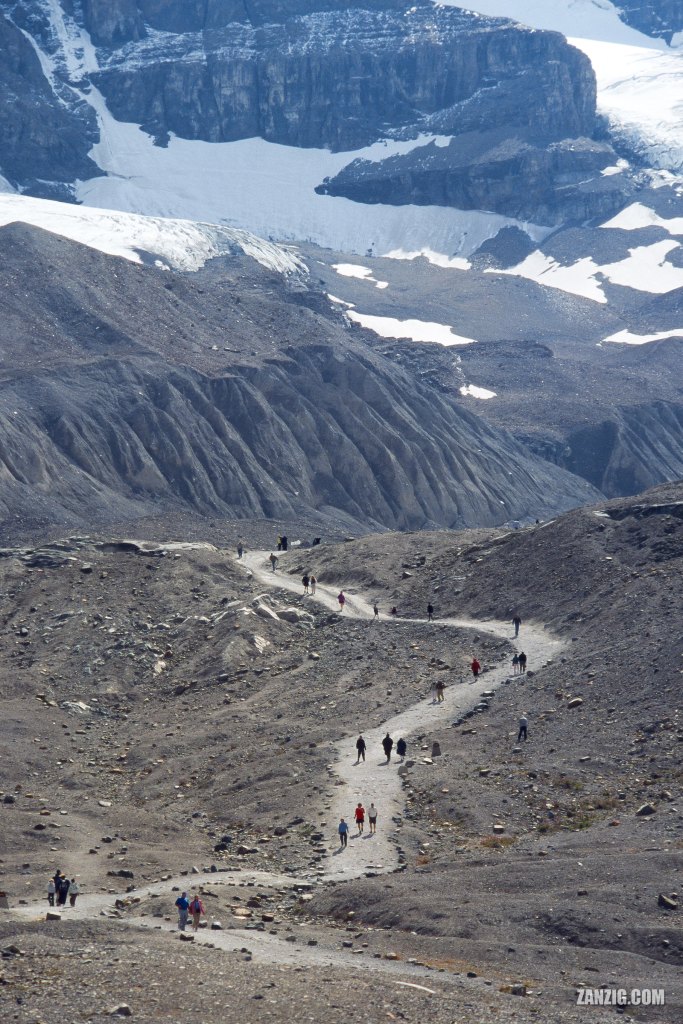
AUGUST 2002 – Hikers walk on the hiking trail that leads up to the Columbia Icefield and the Athabasca glacier on a bright summer day. © Mark Zanzig/zanzig.com
The story behind the image
To conclude the mini series about the Columbia Icefield in the Canadian Rocky Mountains, posted over the past couple of days, here’s a tele shot of the hiking path that leads up to the icefield. It does not look too steep, yet at 2,000 meters altitude you will probably feel every step you make.
It’s interesting to know that the entire path had been covered by the glacier roughly a century ago, so without doubt the ice of this glacier is melting away. With this photo I wanted to stress this point by selectinig a frame that does not actually show the foot of the glacier. You can just see some of the milestones erected by the park management along the hike.
The high resolution image
| Capture Date | 22-AUG-2002 |
| Location | Jasper National Park, Canada |
| Camera | Canon AE-1 Program |
| Lens | Canon FD 300 mm f/4 |
| Image Source | Fuji Slide Film |
| Digital Image Source | Minolta Dimage Scan Elite II |
| Digital Image Source Format | TIFF, 48 bits/pixel, AdobeRGB |
| Edited Image Format | JPEG, 24 bits/pixel, sRGB |
| Edited Image Dimensions | 2469 x 3792 Pixels |
| Copyright | © by Mark Zanzig/zanzig.com |
