
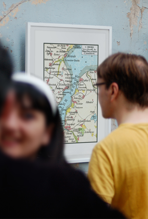
1905 – A city map of Kiel in Germany that was part of a postcard. Scan: Mark Zanzig/zanzig.com
The story behind the image
Every now and then I publish a bonus post. I call it a ‘bonus’ because it’s not a photo (but a scan of an artwork) and may only be relevant for those who actively research the history of Kiel and surroundings. However, looking at the design ideas below, I feel that it may be an attractive wall decoration for your home as well (if you are interested in the region.)
This map was part of a postcard dated 1905. I really like the soft colors, and the fact that the footprint of Kiel looked vastly different back then. The area with buildings is much smaller than today, and on the western side it seems as if the city ends at Belvedere (towards north.) Communities like Altenholz Stift (where I grew up), Friedrichsort or Schilksee were far out on the countryside. Even the quarter called Wik (here: Wick) look detached from the main city.
An interesting snapshot of the past.
Design ideas


The high resolution image
| Published | 1905 |
| Publisher | Hinrich Vöge, Laboe |
| Location | Kiel, Germany |
| Image Source | 5.7 x 8.5 cm Lithography |
| Digital Image Source | EPSON Perfection 4870 Photo |
| Digital Image Source Format | TIFF, 48 bits/pixel, sRGB |
| Edited Image Format | JPEG, 24 bits/pixel, sRGB |
| Edited Image Dimensions | 2622 x 3968 Pixels |
| Copyright | Scan © Mark Zanzig/zanzig.com |
