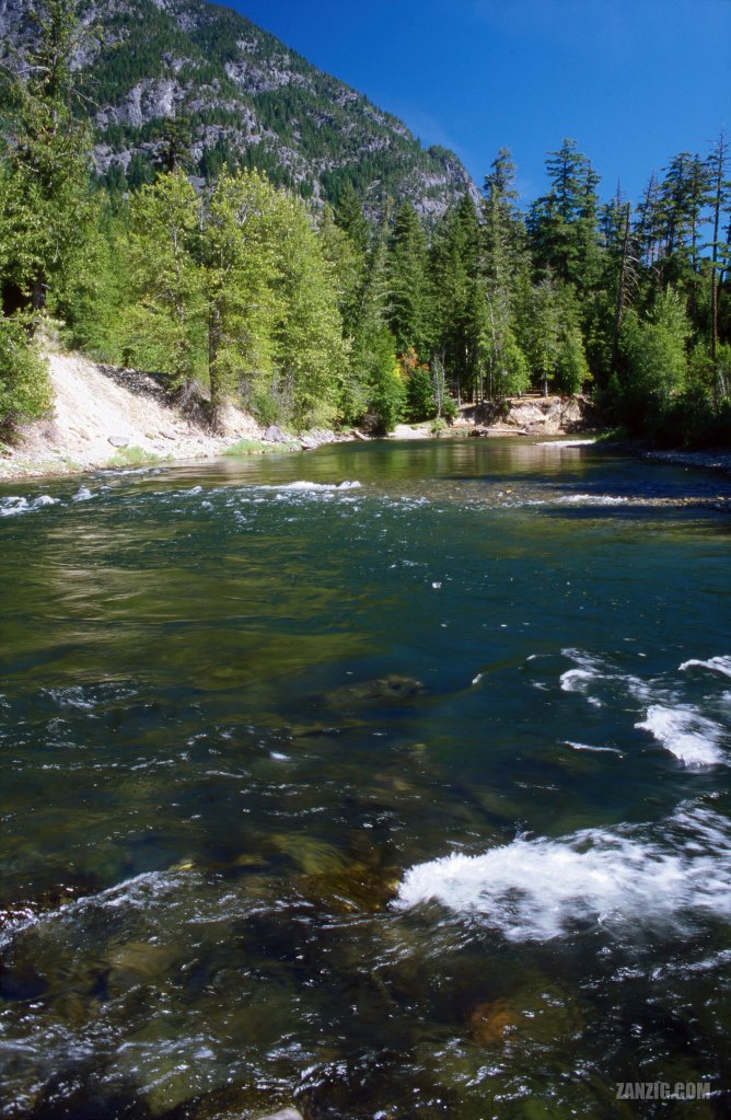
AUGUST 2002 – The Bella Coola River flows through the Tweedsmuir Provincial Park near Bella Coola, British Columbia. © Mark Zanzig/zanzig.com
The story behind the image
Bella Coola in British Columbia is a paradise for nature lovers. Situated at the west coast of the Canadian mainland, it is quite detached from the rest of B.C. and, in fact, the country. The only lifeline is Highway 20 which connects Bella Coola to Williams Lake, the next city. However, it’s a 450 kilometers drive towards east. That’s why the highway is called the Freedom Highway. Back in the 1940s, the government claimed it was impossible to build the road. However, the locals took things into their own hands, and on 26th September 1953 they completed the road. You can find out more about this road at the Bella Coola Valley Museum.
This image shows the Bella Coola River as it flows through the Tweedsmuir Provincial Park. You can almost feel the clear air and the cold, pure water.
The silence was absolute. It was just us, the splashing of the river water, and the gentle wind that was moving the leafs in the trees. No cars. No trucks. No airplanes. (Fortunately, we did not encounter any bears.)
Bella Coola – an awesome place, slightly off the beaten track.
Design ideas


The high resolution image
| Capture Date | 16-AUG-2002 |
| Location | near Bella Coola, B.C. |
| Camera | Canon AE-1 Program |
| Image Source | Fuji Slide Film |
| Digital Image Source | EPSON Perfection 4870 Photo |
| Digital Image Source Format | TIFF, 48 bits/pixel, sRGB |
| Edited Image Format | JPEG, 24 bits/pixel, sRGB |
| Edited Image Dimensions | 4284 x 6563 Pixels |
| Copyright | © by Mark Zanzig/zanzig.com |
