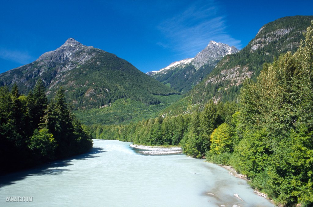
AUGUST 2002 – The Bella Coola River near Bella Coola, British Columbia, on a clear day. © Mark Zanzig/zanzig.com
The story behind the image
Bella Coola in British Columbia is a paradise for nature lovers. Situated at the west coast of the Canadian mainland, it is quite detached from the rest of B.C., and in fact, from the country. The only lifeline is Highway 20 which connects Bella Coola to Williams Lake, the next city. However, it’s a 450 kilometers drive towards the East. That’s why the highway is called the Freedom Highway. Back in the 1940s, the government claimed it was impossible to build the road. However, the locals took things into their own hands, and on 26th September 1953 they completed the road. You can find out more about this road at the Bella Coola Valley Museum.
I took this image from the bridge crossing the river near Bella Coola. I love the clear, saturated colors that visualize the clarity of the air in the region. And the silence and peace we experienced. (Fortunately, we did not encounter any bears here.)
An awesome place to be.
The high resolution image
| Capture Date | 16-AUG-2002 |
| Location | Highway 20 near Bella Coola, B.C. |
| Camera | Canon AE-1 Program |
| Image Source | Fuji Slide Film |
| Digital Image Source | Minolta Dimage Scan Elite II |
| Digital Image Source Format | TIFF, 48 bits/pixel, AdobeRGB |
| Edited Image Format | JPEG, 24 bits/pixel, sRGB |
| Edited Image Dimensions | 3783 x 2512 Pixels |
| Copyright | © by Mark Zanzig/zanzig.com |
