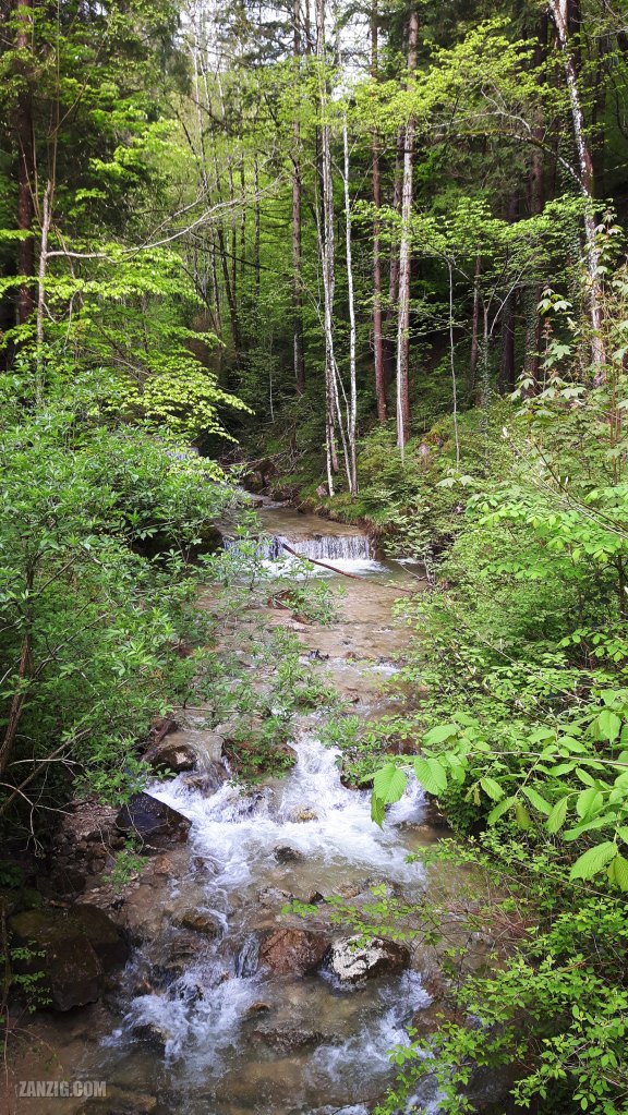
MAY 2023 – View along the Kirchbach near Brannenburg in Bavaria, Germany. Photo © Mark Zanzig/zanzig.com
The story behind the image
Sometimes the good is soo close – but you don’t know it. The hike from Brannenburg in Bavaria to the Farrenpoint is such a fabulous location. Just start at the eastern trailhead (the Sagbruck parking lot), and you will be greeted by a nice road that is protected by large and old trees. Next to the road is the Kirchbach that gently flows downhill, broken up by barrages now and then. That makes it perfect for a warm summer day.
After a short while you’ll get to the Gasthof Schlipfgrubalm, but if you start early it will be too early for a stopover when you get there. But you can continue behind the restaurant and move further up to the Farrenpoint.
Here’s the full track from Sagbruck to the Farrenpoint, tracked with my Garmin Forerunner 645. The height difference is about 600 meters, and everyone – us, our friends, and the kids – managed the track very well.
We recommend to use a slightly different path back to the trailhead. Then you will encounter the Schuhbräualm, and by the time you get there, you may be hungry and thirsty. (Here’s the track.)
The remaining route to the Sagbruck parking lot will follow the road, and will be all downhill, so it’ll be easy. (The track.)
The photo shows the Kirchbach near the trailhead, and one can only wonder how many other places there are still waiting to be discovered by us. My key learning is that beautiful places cannot be found just in Canada, Scotland, or South Africa. 🙂
The high resolution image
| Capture Date & Time | 18-MAY-2023, 08:38 |
| Location | Brannenburg, Bavaria |
| Camera | Samsung Galaxy S5 Neo (SM-G903F) |
| ISO | 40 |
| Exposure | 1/100 sec at f/1.9 |
| Digital Image Source Format | JPEG, 24 bits/pixel, sRGB |
| Edited Image Format | JPEG, 24 bits/pixel, sRGB |
| Edited Image Dimensions | 2592 x 4608 Pixels |
| Copyright | © by Mark Zanzig/zanzig.com |
